ScanSite realises its 3D vision of the future with the Trimble X7
© ScanSite UK
We talked to Lee Chandler, Director at ScanSite about their vision of a 3D future. Here we share their initial steps on this journey.
In May 2019, we had a vision to make laser scanning a viable option for all projects, not just large scale commercial sectors. As a company we had already been using industry leading laser scanners for many years, some of which would still work well in the field today. But we undertook some analysis – we decided to ask ourselves some key questions about the workflow of terrestrial laser scanning and the processing of scan data collected.
We asked ourselves key questions such as:
•What are the average scans times
•-Number of scans per project type
•Number of points captured on average per scan
•Overall project duration
•Average colour iImage quality or no colour at all
•Final size of data sets
•Ongoing maintenance costs, i.e calibration and down time.
We also asked ourselves if our surveyors could do be doing anything else with the "dead" time –those unused minutes between scans?
• Processing, registration times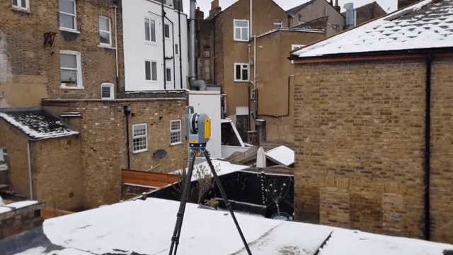
• Geo-referencing time
• Subdivision of data sets
• Optimisation of data
• Point cloud validation
• Sharing
We decided to analyse data from the past five years, compiling an in-depth technical matrix and analysis report which identified various key points in our workflows. From these points we set about the task of developing new workflows and processing software.
A major factor over which we had no control was hardware options. We required a laser scanner which would deliver high precision scanning, in a reasonable amount of time and would offer more services, all at a reasonable cost which was scalable.
Fast forward to September 2019, when we had our first preview of the Trimble X7 with FieldLink. Instantly it made a connection with us and what we were striving to achieve.
Fast forward again to February 2020 and we had our first live demo with the X7. For us this was the missing piece of the puzzle, by not only improving our scanning needs but streamlining registration and geo-referencing which could now be completed onsite. It also added a level of verification by adding BIM models into the scanning process, validating onsite and even being able to collect or layout points to and from the model. Normally this would require additional hardware such as a robotic total station.
We placed our order shortly after the live demo, but unfortunately the UK went in lockdown due to the global COVID-19 pandemic soon after, forcing the majority of workplaces to close, including construction sites. Even under these circumstances, we received our Trimble X7 by the end of May. In between this time our new website ScanSite.co.uk had been developed and already launched, featuring availability with our previous scanners and the upcoming X7. By mid June the X7 was officially available via the website. It has had a beneficial impact on our business as a whole with our combined efficiency and lowered costs.
We now have the ability to scan and deliver project data within 24 hours of on being onsite whilst saving our clients about 30% on average, compared with traditional laser scanning services.
We have been informed by our clients that we are more time and cost effective than their own in-house teams, giving us the nickname “the Uber of Scanning.”
We’ll be publishing a series of spotlights on how ScanSite have used the X7 along with FieldLink, where they have not only improved their efficiency but enhanced their service offer.
© Photos and videos ScanSite UK
Thank you to Lee Chandler and ScanSite