Perfecting the Design–to-Construction Workflow on America’s Largest P3 Project

Customer Profile: ASN Constructors is the design and construction arm of the Red River Valley Alliance (RRVA), a public private partnership (P3) formed to facilitate a 30-mile diversion channel in North Dakota (part of the Fargo-Moorhead Flood Risk Management Project). RRVA is an international consortium of private builders consisting of ACCIONA, Shikun & Binui USA, and North American Construction Group.
Business Challenge: Establish a technology-enabled workflow that streamlines productivity and daily progress tracking
Technology Solutions:
- Trimble Business Center
- Trimble Earthworks Grade Control Platform (excavators and dozers)
- Trimble GCS900 Grade Control Systems
- Trimble WorksManager Software (all machines)
- Trimble WorksOS Software (quantity checks)
- Trimble R750 GNSS Modular Receiver
- Trimble Internet Base Station Service (IBSS)
- Trimble TSC7 Data Collector
- Trimble Access field software
- Trimble R780 GNSS Smart Antenna
- Trimble Stratus Software
- Trimble SX12 Scanning and Total Station
- Trimble Siteworks Site Positioning Software
- Trimble Connect
- Trimble SiteVision
The Fleet:
- 17 Trimble Earthworks-equipped excavator and dozers
- 9 GSC900-equipped wheel scrapers
Benefits
- Pushing new designs to machines instantly
- Use reality capture to visually show stakeholders and constituents real-time progress
- Live updates of where machines are and how blades are interacting on the model
Preventing catastrophic damages for 260,000 people
Located on both sides of the North Dakota-Minnesota border, the Fargo-Moorhead Area Diversion project will bring permanent, reliable flood protection to the Fargo, North Dakota and Moorhead, Minnesota area. It will protect nearly 260,000 people and their homes, businesses and property from flooding. It is also the first United States Army Corps of Engineers (USACE) public-private partnership (P3) and one of the first large-scale, environmental, social and governance (ESG)-focused P3 transactions in the United States. The channel is designed to withstand a 100-year flood and provide resiliency for a 500-year flood.
The project includes a five year plan, a 30-mile stormwater diversion channel, two first-of-its-kind aqueducts, and a number of inlets, bridges and roadways. It also requires more than 30 GNSS-enabled machines and a digital workflow unlike any other on a project of this scope and scale.
The Metro Flood Diversion Authority selected the Red River Valley Alliance (RRVA), an international consortium of private builders consisting of ACCIONA, Shikun & Binui USA, and North American Construction Group, and its design and construction arm ASN Constructors, to facilitate the project. Specifically, the consortium is charged with developing, designing, construction, operating and maintaining the channel for three decades after construction.
For ASN Constructors, a group formed in 2021 specifically for this project, it’s an opportunity to demonstrate the productivity, collaborative and connected benefits of technology across a project from design through construction and even maintenance.
As Daniel Wagner, survey construction manager with ASN Constructors, confirmed, “The biggest challenge of this project is coordination and logistics.”
Therefore, every individual on the project is equipped with some form of connected technology, from the supervisors, surveyors and operators in the field to the project managers and model developers in the office.
Assured Design Intent
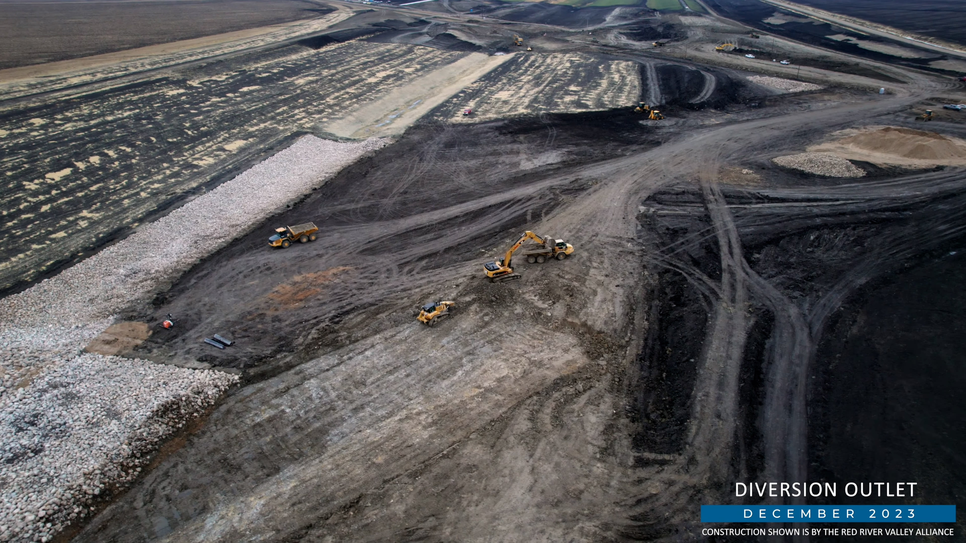
The Fargo-Moorhead diversion channel project is broken up into 14 reaches, which are each around 2-3 miles long. Every reach incorporates channel components such as the outer ditches, engineered materials embankments, maintenance roads and levee inlets. ASN broke ground on several of the reaches in 2022 with peak construction scheduled for 2024-2025. The organization has worked for the last year to set up a consistent, repeatable — and entirely digital — workflow.
Daniel Wagner, survey construction manager with ASN Constructors, said, “One of the critical drivers on this project is safety of our crews in the field. Access to the long-time and continually changing jobsite with dozens of pieces of moving equipment is always a challenge. Our challenge on this project was to keep our team, particularly our survey crews, as safe as possible and as remote as possible. Our continually advancing digital and connected workflow is doing that and much more.”
The first step on every reach is to verify design data with aerial mapping.
On a weekly basis, the survey team relies on Trimble® Stratus for mapping topographical information on the site to gather existing conditions. “If there are discrepancies between the design data and the aerial scans, we are able to visually show that to the customer inside Trimble Stratus.”
However, from the surveyor’s perspective, the aerial data is not the precision needed for models that will be used in equipment. “UAVs are a great tool for gathering a lot of very accurate data,” said Wagner. “We also collect data on the ground with a suite of Trimble survey solutions including ground-based LiDAR scanning to the workflow. That data goes back to the model as a quality control check, and the model is then passed along to the engineer-of-record.”
The aerial and ground-based data is processed in Trimble Business Center, and eventually moved to Autodesk Civil 3D for more detailed model development.
“That is our model workflow for every single reach,” Wagner said.
That full suite of connected office and field technology is essential to keeping this program on track and on time.
Josh Pape, construction technology supervisor for SITECHⓇ Dakotas, said, “One of the early steps in the project was to standardize the technology. While there would be different iron manufacturers, the foundational solutions would be Trimble. That was key for the ASN surveying department because it meant that group would not have to deal with so many file types — and could push out designs as they changed or even tweak things quickly and easily in near real-time.”
High Performance Field Connections
Once a reach is ready to begin construction, the detailed models are translated and sent to a Trimble data collector within Trimble Business Center or with the Trimble Link add-on within Autodesk Civil 3D that facilitates the translation of DXF line work, XML surfaces or road alignments.
All of ASN Constructors machines are provided by Fargo-based Butler Machinery, which are all equipped with Trimble Earthworks or Trimble GCS900. That fleet currently includes 17 Trimble Earthworks-equipped excavators and dozers and nine GSC900-equipped wheel scrapers – though those numbers are likely to increase significantly in 2024 as work on the ground accelerates.
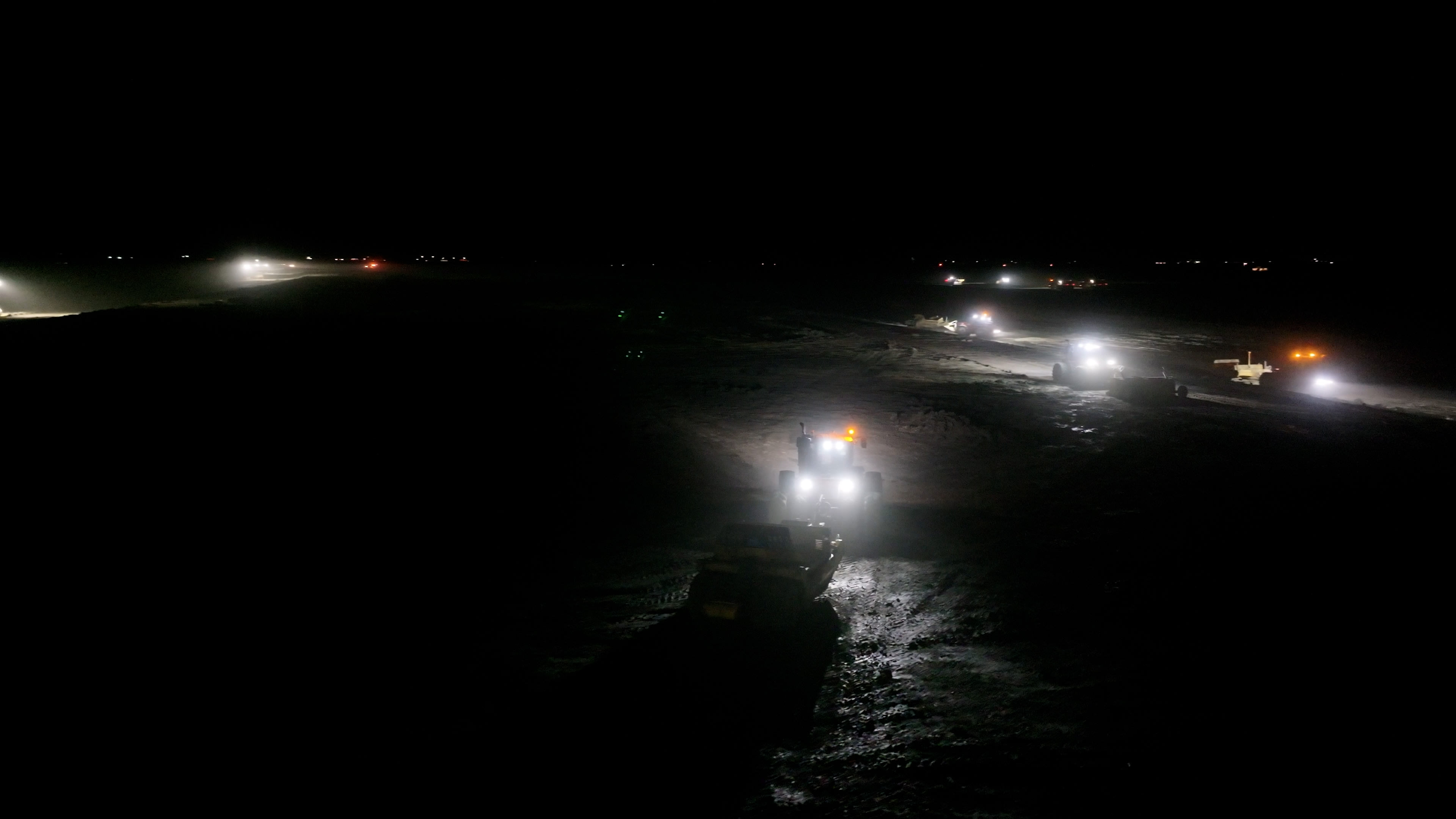
The team also has Trimble Earthworks on the excavators, dozers and an array of other solutions to facilitate the transfer of information to and from the field. “The GPS-enabled equipment allows for a defined workflow or a means and methods for grading a site,” said Wagner. “It allows our operators to be a little bit more automatic in their daily activities, and they can trust the [Trimble] Earthworks software to give them timely feedback as they move. This is particularly beneficial as we are now a 24/7 operation.”
One of the challenges of this project that was recognized from the outset was the need to have a clear and continuous connection at all times. “Key in our technology workflow evolution is our partnership with SITECH Dakotas. We look to them to help make digital connections. For instance, we have over 60 designs loaded in these machines at any one time right now. We needed a way to ensure a streamlined process. The easiest way to do that is using Trimble WorksManager,” he said.
Trimble WorksManager is an intuitive, user-friendly software purpose-built to share models with field-based devices. “I can update models with my phone, tablet or in the office,” said Wagner. “I can publish something new, do take-offs, use field data from the excavator and build a temporary retaining wall or ditch. It's very virtual, very convenient.”
The field solution is also ideal for sharing data from a variety of sources with ease. ASN Drone Program Manager Anthony Herman, explained, "There's a lot of shortcuts we can take between our Trimble solutions. For instance, our surveyors can get high resolution, very large files from Stratus. That same data can move through Trimble Connect for ready import into WorksManager or WorksOS. If we have something we need to take a look at, I can give my surveyors the surface via WorksManager, and have it go directly into their data collectors rather than having to download and convert to XML."
In addition, ASN Constructors surveyors rely on Trimble Siteworks and Trimble Access to verify work in the field.
Wagner continued, “We have different surveyors with different backgrounds, and we also have our own operators and supervisors that have background in more of the construction side. That's where Siteworks is a big advantage. It’s a simplified version of some of the other survey tools that we commonly use.”
A Connected Collective
When asked about connectivity, Wagner confirms that the region is overall very flat, but when building a channel that is more than 30 feet deep, GNSS signals can be problematic. Base stations simply couldn’t cover the entire area.
“We look to our partners at SITECH Dakotas for ideas and options to help solve these issues,” said Wagner.
Pape said,“That’s when we introduced the idea of running Trimble IBSS out on those base stations. We’re on this project regularly trying to be consultants for them, to streamline activities, and make this project go as smoothly as possible.”
Wagner confirmed, “That’s why we went with IBSS and it’s working very well. We also set up permanent base stations on fixed structures that send out radio corrections.”
ASN Constructors can also send out Trimble IBSS for real-time kinematic (RTK) data or differential GNSS corrections from a base station over the internet via Wi-Fi or the internal 4G LTE modem.
Inside the Channel
For every cut, there’s a fill…and in this case, a laser scanning total station helps keep progress reporting accurate and quick.
Wagner explained, “Because of the pit size, the SX12 laser scanners allow us to create a model of what has been excavated.”
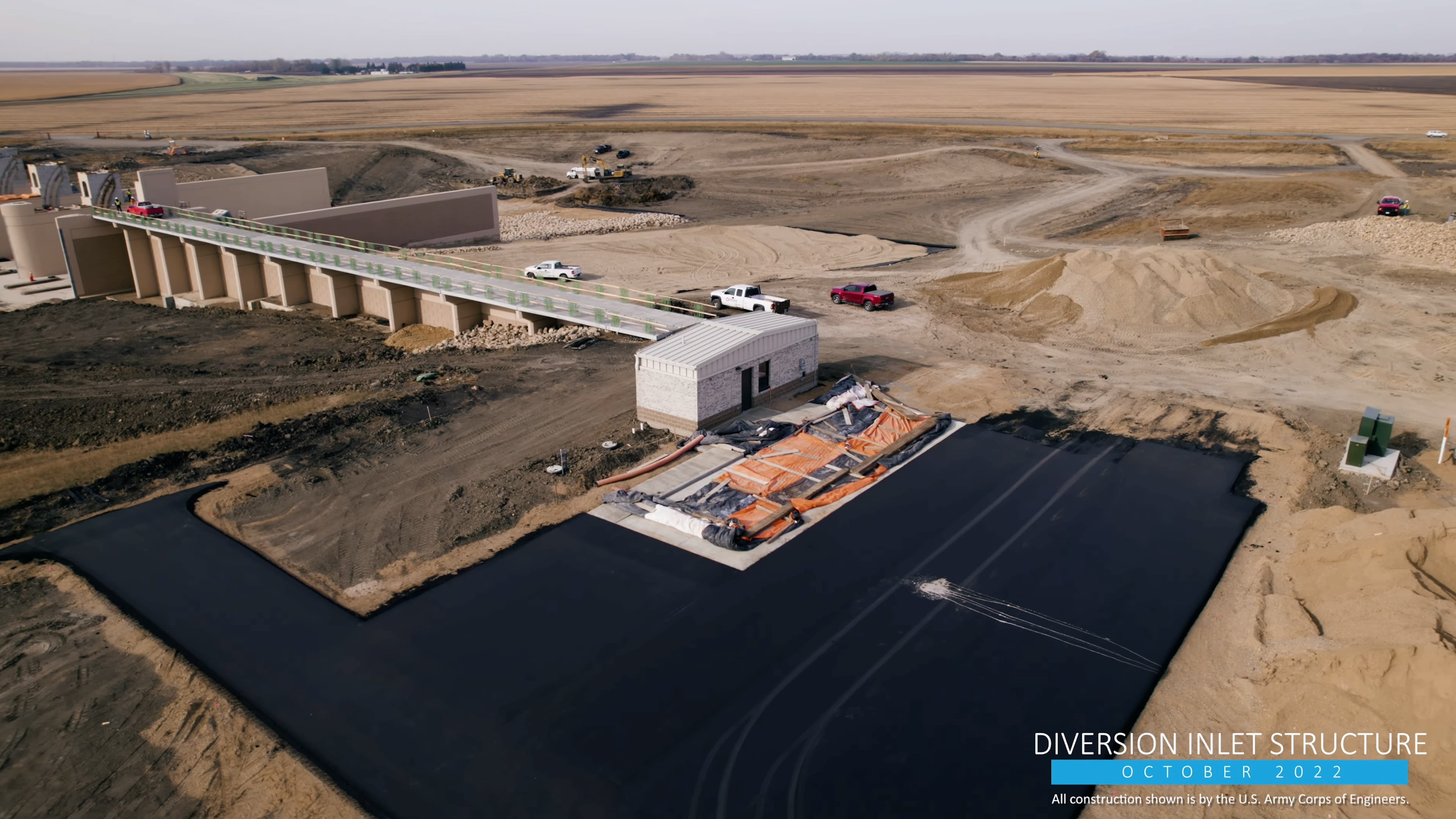
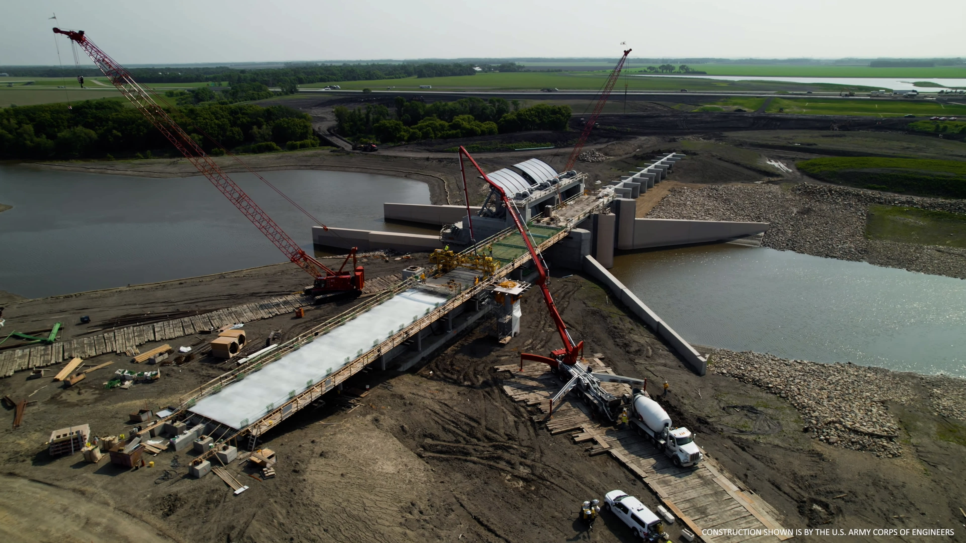
The aqueduct is a good example. The Maple River aqueduct will maintain biological connectivity and fish passage in the rivers. It includes a grade control structure to prevent headcutting on the tributary, an inlet structure to control diversion of tributary flows, heating components for cold weather operation, and an aqueduct to pass a limited flow over the diversion channel to maintain the desired downstream flow. The aqueduct is constructed off-channel with the river diverted across the aqueduct upon completion. Constructing it will require the movement of some 120,000 cubic yards of material that will be moved to the lagoon site.
Wagner said, “We use the scanner for excavation purposes, we also use it to locate the H-piles, of which we have about 660 to install between the flume bottom and the wing walls. It’s a very congested area, but we need to locate the H-piles positions and angles with great accuracy. One of the easiest and most accurate ways to show that we placed these correctly is a 3D panoramic scan.”
Since then, the scanner has become an integral part of the larger job including to scan bridge progress, inlets, roads, etc.
“The benefit of having newer GNSS-enabled equipment is that we’re getting feedback from the field constantly,” said Wagner. “We can update our models very quickly to match as constructed conditions, a capability that has become particularly valuable after a weather event.”
Herman added, “This digital workflow gives us immediate information about what work has been completed, how long it took, volumes associated with that work and, just as importantly, connects with what we plan to do. We can easily connect with our construction divisions about what sort of equipment and labor it actually took to accomplish the work. It’s a feedback loop to improve our processes. We can accurately forecast if we need additional scrapers, a different excavator, etc..”
In the big picture Herman believes the ASN team is more sustainable. “We can accurately determine how much equipment we need to leave on-site over the winter and still be productive. We don't want to be wasteful with the movement of equipment across interstates and railroads, which requires permits. On a 30-mile-long project, equipment movement takes on much greater significance.”
Weather is also a concern on a multi-phase project. Since construction spans several years, the chance of heavy rain events is very high, which requires flexibility from the construction crews. “We have to be able to address in-work areas that have been oversaturated, for instance, which requires drying out and regrading. The laser scanner is great for quickly supporting those kinds of adjustments,” he continued.
The construction of the diversion channel has now finished the first of the five year effort. Field crews have grown to over 100 people in less than twelve months. “We’re continually looking to improve our operational workflow,” said Wagner. “We’ve got a great foundation and with help from SITECH and Trimble, we’ll keep this digital workflow moving forward with digital synchronicity.”